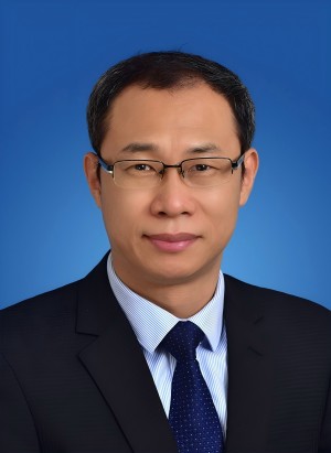
JIANG Liming, male, Ph.D., member of the Communist Party of China, deputy Director of the Innovation Academy for Precision Measurement Science and Technology, Chinese Academy of Sciences (APM, CAS), where he holds the positions of Researcher and Doctoral Supervisor, as well as Deputy Director of the Geodesy Research Department. Recognized as a leading talent in scientific and technological innovation under the National “Special Support Plan”, he is also a leading young and middle-aged scientist designated by the Ministry of Science and Technology, and has been selected for the CAS “Talent Attraction Program”. He is the head of an innovative research group funded by the Hubei Provincial Natural Science Foundation, and a recipient of the Hubei Provincial May 1st Labor Medal.
In addition to his primary positions, Professor JIANG concurrently serves as a Professor at the University of Chinese Academy of Sciences, a member of the expert group in Earth observation for China's manned lunar exploration program, a member of the Earth observation working group for the Sino-Russian International Lunar Research Station, a Standing Committee Member of the Digital Polar Committee of the International Society for Digital Earth, and an Editorial Board Member of the international journal "Geodesy and Geodynamics".
Oriented towards the frontier of aerospace information technology and addressing national major demands, Professor JIANG has achieved numerous groundbreaking innovations in the theory, methodology, and application of precision measurement using Synthetic Aperture Interferometric Radar (InSAR). His contributions have provided vital scientific and technological support for national strategic tasks such as the Qinghai-Tibet Scientific Expedition, the Sichuan-Tibet Railway, island reef security, lunar exploration, and the 2020 "Mount Everest Elevation Measurement".
Professor JIANG has published over 150 academic papers, including 105 SCI-indexed articles (with one collaborative paper in Science and one in Nature Geoscience). He has co-authored four books in both Chinese and English and has been granted 11 national invention patents. He has presided over and undertaken 10 national-level projects, including major projects of the National Natural Science Foundation of China, national science and technology support programs, national key research and development programs, and key national defense pre-research projects. He has also served as the Chinese leader in multiple international cooperation projects related to geodesy and remote sensing satellite plans with Germany, Europe, and other countries, fostering high-level and comprehensive cooperation among domestic and international teams in the fields of photogrammetric geodesy research, talent cultivation, and academic exchanges.
His achievements have been recognized with prestigious awards such as the First Prize of the China Surveying and Mapping Science and Technology Award in 2020 and 2021 (ranking 3rd out of 12 and 1st out of 10, respectively), the Outstanding Scientific and Technological Achievement Award of the Institute of Precision Measurement in 2021 (ranking 1st out of 8), and the Special Prize of the China Geographic Information Science and Technology Progress Award in 2023 (ranking 4th out of 12).